2012-12-06 21:50:27
The United States has presented Lebanon and Israel with a map proposing how they might bypass their border disputes in order to advance exploration for natural gas buried under their territorial waters, a senior State Department official publicly revealed for the first time last week.
“The ideas we have presented for boundaries were addressed by the highest standards of cartography and science–not politics,” Deputy Assistant Secretary of State for Energy Diplomacy Amos Hochstein told an Aspen Institute meeting on Eastern Mediterranean energy issues last week (November 29). “We believe they are the right boundaries.”
“This is not a matter of changing the borders. Let’s not confuse those,” Hochstein cautioned. However, he continued, “addressing these boundaries would remove at least one area of potential conflict between [Eastern Mediterranean] countries and give confidence to investors.”
Though he declined to comment on details of the diplomatic exchanges, “I will say they [the discussions] have been going forward trying to address it from a reasonable, equitable, perspective of best practices.”
According to a United States Geological Survey, “the Levant Basin, shared by Lebanon, Israel and Cyprus, offers up about 122 trillion cubic feet in recoverable gas and an estimated 1.7 billion barrels of oil,” Forbes magazine’s Christopher Coats reported last month.
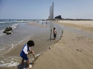
(Photo: Children play on the beach as a power station in the coastal city of Hadera is seen in the background May 19, 2012. Israel Electric Corp (IEC) is having trouble keeping up with demand. REUTERS/Amir Cohen.)
Read more: http://backchannel.al-monitor.com/index.php/2012/12/3411/us-proposed-map-to-israel-and-lebanon-to-advance-maritime-gas-exploration/#ixzz2EIqjQFFV
InfoGnomon
“The ideas we have presented for boundaries were addressed by the highest standards of cartography and science–not politics,” Deputy Assistant Secretary of State for Energy Diplomacy Amos Hochstein told an Aspen Institute meeting on Eastern Mediterranean energy issues last week (November 29). “We believe they are the right boundaries.”
“This is not a matter of changing the borders. Let’s not confuse those,” Hochstein cautioned. However, he continued, “addressing these boundaries would remove at least one area of potential conflict between [Eastern Mediterranean] countries and give confidence to investors.”
Though he declined to comment on details of the diplomatic exchanges, “I will say they [the discussions] have been going forward trying to address it from a reasonable, equitable, perspective of best practices.”
According to a United States Geological Survey, “the Levant Basin, shared by Lebanon, Israel and Cyprus, offers up about 122 trillion cubic feet in recoverable gas and an estimated 1.7 billion barrels of oil,” Forbes magazine’s Christopher Coats reported last month.
(Photo: Children play on the beach as a power station in the coastal city of Hadera is seen in the background May 19, 2012. Israel Electric Corp (IEC) is having trouble keeping up with demand. REUTERS/Amir Cohen.)
Read more: http://backchannel.al-monitor.com/index.php/2012/12/3411/us-proposed-map-to-israel-and-lebanon-to-advance-maritime-gas-exploration/#ixzz2EIqjQFFV
InfoGnomon
ΜΟΙΡΑΣΤΕΙΤΕ
ΔΕΙΤΕ ΑΚΟΜΑ

ΠΡΟΗΓΟΥΜΕΝΟ ΑΡΘΡΟ
Στουρνάρας στην κόρη του: Μείνε στο ενοίκιο

ΣΧΟΛΙΑΣΤΕ